Now I am in my sixth decade - My Sixties. Here I share my travels, observations and musings on life - its purpose and meaning.

Now I am in my sixth decade - My Sixties. Here I share my travels, observations and musings on life - its purpose and meaning.

Monday, September 22, 2014

Olympic National Park - Part I The Coast

Rialto Beach, Olympic Peninsula
The Olympic Peninsula in Washington State is home to Olympic National Park.  Like the peninsula, the park has several distinct parts: the Pacific Coast, temperate rain forests, high mountains, and glacial lakes.  We recently visited the park spending time in each area, beginning with the coastal region.

We began at Kalaloch, a NPS lodge overlooking the Pacific Ocean.  It had been raining on the 3 hour drive from Seattle, but when we arrived the clouds were parting and the rain had stopped.  Unlike our Atlantic beaches in the Southeast, there are few broad sandy beaches on the Olympic Peninsula.  Thick forests of spruce line the headlands and most beaches are reached by a trail that leads down to the water.

Kalaloch Creek reaches the Pacific Ocean at the Kalaloch Lodge and restaurant.

Evening light and clearing skies silhouette a tree on the coast.


Above and below: Pacific Ocean sunset


The Spruce trees at Beach #1 have formed large burls.  While burls are not unusual, the concentrations of them makes this area unique.
Numerous burls on spruce trees.


At beaches farther north we began seeing sea stacks, more drift logs (drift trees really) and some sea stars as the tide went out.  Enjoy the pictures!

Sea stars cling to rocks as the tide goes out.


Sea stacks at Ruby Beach.

Morning light through the trees.
Drift logs at Rialto Beach.

One huge drift log!

Rough surf and distant sea stacks.


Thursday, September 18, 2014

Maddron Bald to Cosby Campground

Yes, we were hiking right by Campsite 29 and the "aggressive bear activity."
A yellow sign attached to the Maddron Bald trailhead sign provided a wake up for me when I arrived.  I wasn't planning on camping, just passing through, so bear or not five of us started hiking at  8:45.  Our hike would take us along the Maddron Bald Trail over the bald of the same name, connect to the Appalachian Trail and hike north to Low Gap Trail which would take us to Cosby Campground.

We faced a long climb - from 2000 feet to 5800 feet - from the trailhead to the Appalachian Trail over 7.9 miles.  It was overcast and a little cool, but the climb warmed me up quickly.  Within a mile we came upon the Baxter Cabin, one of many cabins restored by the park service.  It was built in 1889 by Willis Baxter.

Almost every trail in the Smokies follows and crosses streams that course over the landscape.  The Maddron Bald trail has 9 crossings of several streams, a couple with foot logs, the rest either rock hopping or wading.  Footbridges are convenient, but are subject to removal by flooding.  Rock hopping means you can keep your hiking boots on.  Wading means either get wet boots or change into water shoes and wade across.  Since I knew we would be making several wet stream crossings over a two mile stretch, I kept my water shoes on so I would only have to change shoes twice.

Footlog over none of the numerous creeks we crossed.
Wading across streams lets you enjoy the upstream views at stream level.  Moss covered rocks and rushing water make for great "Kodak moments."


Logging cleared much of what is today the Great Smokies Mountains National Park, but there were areas that were too steep and too remote for commercial logging.  As we climbed higher we soon began to see some forest giants - poplar and tuliptree, American beech, and silver bells - that had escaped the loggers.  Albright Grove Loop Trail branched off and wound it way through the giants.


After 8 miles we reached the AT and a well deserved lunch break.  It was foggy and after sitting for a few minutes the chilly 50 degrees had me putting on a jacket.  We hiked north on the AT toward Low Gap.  Along the way the sun came out and we came upon a volunteer trail crew doing some heavy work on the trail.  Many thanks to trail crews how make the trails safer and a joy to hike!


The Low Gap Trail has two parts; one part leads toward the Big Creek area, and the other leads to Cosby Campground.  We took the trail that led downhill toward Cosby. The trail was rocky and rooty, but well graded.  We covered the 2.9 miles in short order and arrived at the cars at 5:15.  A short car shuttle took us back to the Maddron Bald trailhead.

One last look at Cosby Creek.
Tale of the tape:
Total miles hiked: 16.5
Elevation gain: 4066 feet
New trail miles: 15.5
Total trail miles to date: 236.6

Thursday, August 28, 2014

Noland Divide and Noland Creek in the Smokies

This week the Margaret Stevenson Wednesday Hikers sponsored one of its bus hikes.  Different hikes are organized beginning at trailheads along the Clingmans Dome Road off Highway 441 and ending in the Deep Creek/Lakeview Drive area near Bryson City, where a chartered bus picks up the hikers and takes them back to their cars parked at the trailheads.  This allows for longer hikes without having to shuttle cars back and forth from one end of the hike to the other.  35 hikers on five separate hikes used the bus shuttle.

I joined four others on a 20.6 mile hike on part of the Noland Divide Trail, the Noland Creek Trail, and a part of theSpringhouse Branch Trail.  A long hike means an early start; we began with headlamps at 6:10 AM.
Trailhead sign illuminated by my headlamp. On to Noland Creek.
The predawn sky was brilliant with stars, but they quickly vanished as were entered the red spruce forest.  A faint line of light to the east slowly brightened and light began filtering through the trees as we headed down the trail.  There was some conversation, but mostly we enjoyed the quiet solitude of experiencing nature greeting a new day.

We covered the 3.8 miles to the Noland Creek Trail fairly quickly, stopping only once to remove a layer as the day warmed with the sun.  At this point the Noland Divide Trail generally follows the ridge line of the Noland Divide, another 7.8 miles to Deep Creek near Bryson City.  The Noland Creek Trail follows Noland Creek, first its tributaries and then the creek itself.
Noland Creek Trail - 4.8 miles to Springhouse Creek Trail
When you look at a trail map of the Great Smoky Mountains National Park, you notice that several trails follow and are named for divides and ridges or creeks.  The main spine of the park is the long line of high peaks on the NC/TN border; the Appalachian Trail generally follows this undulating line for 74 miles from Fontana Dam to Davenport Gap.  Several lateral ridges extend from this spine creating divides that separate large watersheds between the ridges.  

The sound of Noland Creek grew louder as we descended on the well-graded trail.  Soon, the trail followed an old roadbed, evidence that this area was once home to several farm settlements and later logging operations.  Our gradual descent changed with a side hike up Springhouse Branch Trail.  The trail climbs up Forney Ridge, and eventually descends to Forney Creek.  We hiked the 2.8 miles up to Forney Ridge.  Along the lower part of the trail we saw stone walls and fallen chimneys, all that remains of the homesites of the farm community that once supported several families.

Springhouse Branch Trail - it is steeper tun it looks here.

Remnants of a stone wall.
All that remains of a fireplace, evidence of a cabin.
Frank, our hike organizer had information about the homesite of Cornelius Laws and some graves just off the trail.  The remains of the chimney were easily seen, but the graves were not marked.  Reportedly there are five Indian graves near the homesite.  Using his dowsing rods, Frank located the graves not far from where they were reported to be.  Dowsing showed two rows of graves, three in one and two in another.  Were they Indian graves?  Our compass showed them to be north-south oriented, which is consistent with Indian graves.  White settlers were almost always buried east-west, with the headstone facing east.
The remains of the fireplace at the Laws home site.

Frank dowsing for evidence of graves.  You can make out the wire rods he is holding.  They cross when held over a grave.
After lunch at the Springhouse Branch/Forney Ridge trail junction we retraced the 2.8 miles back to Noland Creek and then continued 5.2 miles to the end of the trail.  The trail ends close to where Noland Creek flows into the Tuckaseegee River near its confluence with Fontana Lake.  We hiked back one mile to Lakeview Drive where we waited for the bus to pick us up and take us back to our cars near Clingmans Dome.  Total time from when I left may car in the morning to the time I got back to it was just under 13 hours.

A day of bright sunny weather, good company, and the always beautiful and varied landscape of the Smokies.

Tale of the tape:
Total miles hiked: 20.6
New trail miles: 16.8
Total trail miles to date: 221.1

Monday, August 18, 2014

Found a New Ride on Today's Hike

Several old cars can still be found on the Lakeshore Trail on the North Shore of Fontana Lake.  Why were they left  behind?  Read on to find out.
Today's hike in the Smokies began and ended at Fontana Dam.  It was raining fairly hard when we started on the Appalachian Trail where it enters the Great Smoky Mountains National Park.


The 3.7 mile to the Lost Cove trail took us steeply up Shuckstack Mountain and the old fire lookout tower on the summit.   The tower was built in 1934, rising 60 feet to give a 360 degree view of the Smokies and Nantahala National Forest, as well as Fontana Dam and Lake.  It rained off and on on the way up to the tower, but it did clear some for cloudy views of the surrounding mountains from the tower.  Fontana Lake and the dam are visible in this picture.


A little past the side trail to the tower, the Lost Cove Trail turns off the AT on the right.  This short trail (2.7 miles) follows Lost Cove Creek and features several stream crossings.  The upper end of the trail is steep, and with today's rain, we slipped and slid down the muddy trail.  The first stream crossings were rock-hops, but on the lower part of the trail we waded across the last five crossings.


Lost Cove Trail ends at the Lakeshore Trail, a 35 mile trail that follows the North Shore of Fontana Lake.  Parts of the Lakeshore Trail follow old NC Highway 288 which followed the Little Tennessee River between Bryson City and Deals Gap.  Today much of this road lies at the bottom of Fontana Lake.  Prior to 1944 and the construction of the dam, many people lived on what is today called the North Shore.  Several towns and homesteads dotted the landscape.

Although the trail sign (above right) is hard to read, we hiked 5.2 miles of the Lakeshore Trail to the parking area near the dam.  It is along this section you will see several abandoned vehicles left behind by people who moved, or were removed, from the area because of the dam and lake.


We had some views of the lake through the trees as we hiked along, and the morning rain gave way to afternoon sunshine.

So now to answer the question posed in the caption of the picture at the beginning of this post.  Why did the people leave so many cars behind when they left the area in the 1940s?  One would think these cars had value and would be useful in resettled areas.  These were wartime years, and rationing during World War II included tires.  Rubber was needed for the war effort.  So cars in otherwise good running condition may not have had tires to drive them away.  By the time tires would have been available after the war, the lake had cut off road access and the people had moved away.  So, here they sit along the Lakeshore Trail, a reminder of the past.

Tale of the tape: 12.5 miles; all "new" trail miles with 3,000 feet elevation gain.
Total miles of trails in the Smokies to date: 202.8 (1/4 the way!!)


Friday, August 15, 2014

Trail Math: When does 15.3 = 3.6?

Many trails in the Great Smoky Mountains National Park can only be reached by hiking to them on other trails.  Such is the case with the Bone Valley Trail.  It is a short trail - only 1.8 miles one way - that follows Bone Valley Creek ending at the Hall Cabin, one of several historic structures maintained by the Park Service.  In fact, the Hall Cabin is the most remote maintained structure in the park.  In order to get to the Bone Valley trailhead, one must hike 6 miles from the boat landing at Hazel Creek on the Hazel Creek Trail.

Before I explain the math equation in the title, here are a few pictures and notes from the hike a group of us did on August 13.

We met at the Fontana Village Marina for our boat shuttle across the lake to the Hazel Creek landing. The morning was cool and mist rose from the surface of the lake.

Early morning on Fontana Lake

Morning clouds and mist.
We began our hike at Ollie Cove on a short spur trail (0.3 miles) and 0.7 miles on the Lakeshore Trail to Hazel Creek.  This area of Fontana Lake's North Shore was the site of the town of Proctor.  It began as a farming settlement, and by the early 1900s, it was a booming lumber mill.  Once the timber was cut, the mill was shut down and the area reverted back to a faming community.  With the construction of the Fontana Dam and as the lake filled, communities like Proctor on the north shore were cut off from roads of lost under the rising waters.  Read more about Proctor here.

As the name implies, the Hazel Creek Trail follows Hazel Creek upstream for about 12 miles.  We hiked 5.3 miles to the junction with the Bone Valley Trail.  Hazel Creek is more a river than creek in size.  With the rain we have had in the past few weeks, it was running fairly high.  Sturdy bridges provide trail crossings of the creek.  

Hazel Creek from one of the bridges.

Bone Valley got its name in 1877 when an early spring blizzard caught a herd of cattle with no shelter and they froze to death.  Their bones littered the valley for many years, though none are seen now!

The Bone Valley Trail follows Bone Valley Creek for 1.8 miles.  It is an old road that allowed families that lived in the valley access to the road to Proctor, and before the Fontana Lake, the "outside world."  There are no foot logs across the creek, so there are four wet crossings on the trail.

Crossing Bone Valley Creek

A reminder of logging operations: a rail wheel beside the trail.
At the end of the trail stands the Hall Cabin.  Craten Hall settled in Bone Valley in 1877.  The cabin dates to 1892. A half mile beyond the cabin is the Hall family cemetery, where many of the family are buried.


After lunch at the cabin and a visit to the cemetery, we reversed the hike and returned to the boat landing to catch our boat shuttle back across the lake to the marina.  This leads me to the equation in the title: When does 15.3 = 3.6?  When accounting for trails hiked in the Smokies, you only get new trail miles; that is, miles of trails not hiked before.  Since I had already hiked 4.5 miles of the Hazel Creek Trail earlier and the access trail to the boat landing, this hike only netted me 3.6 miles of "new" trail miles:Ollie Cove (0.3), a short section of Lakeshore Trail (0.7), 0.8 new miles on the Hazel Creek Trail, and 1.8 miles (one way) on the Bone Valley Trail.  So, a day's hike of 15.3 miles netted me 3.6 miles of previously un-hiked trails.  Not all days are like that, but when trails like Bone Valley are remote, using previously-hiked trails is the only way to reach them.

But it is not only about the miles you mark in the map.  When you have a beautiful day, trails along rushing streams, wildflowers, and good company, just being on the trail is enough.  Who could ask for more?
A species of orchid.


Charlies Bunion

Charlies Bunion is not found on a foot.  It is a rock outcrop just off the AT about 4 miles north of Newfound Gap in the Great Smoky Mountians National Park.  Three of us were scouting a hike for the Carolina Mountian Club, joining the Friends of the Smokies hike to Charlies Bunion as a part of the scout.  It was raining when we left Newfound Gap, and while the FOTS hikers were deciding if they wanted to begin a hike in the rain, we started north on the AT.  After an hour, the rain lessened, and by the time we reached the Bunion, there were breaks in the clouds and hints of sun.

Charlies Bunion View

Instead of retracing our route back to Newfound Gap on the AT, we returned on three trails: Dry Sluice (upper part), Grassy Branch, and Kephart Prong.  As the afternoon progressed we saw more and more sun.  The trails were wet from the previous days rain, but not difficult to hike.

 Grassy Branch and Kephart Prong Trails both followed streams that grew in volume as we descended in elevation.  With each mile, the sound grew louder.  We crossed Kephart Prong four times on foot logs.


Kephart Prong

The tape: 10.2 miles on 4 trails.

Monday, July 28, 2014

Hiking in the Smokies - May- July 2014

The Great Smoky Mountains National Park has over 800 miles of hiking trails.  These trails are located in all areas of the park, with trailheads located off the major roads such as Hwy 441 and Little River Road and in more remote areas like the North Shore of Lake Fontana and the Twentymile area. The longest trail is the AT which runs 71 miles through the park.  I have done some hiking over the years in the Smokies, but recently I began hiking there more.  My goal is to hike all the trails; time will tell!

Using the official Great Smoky Mountain Association 
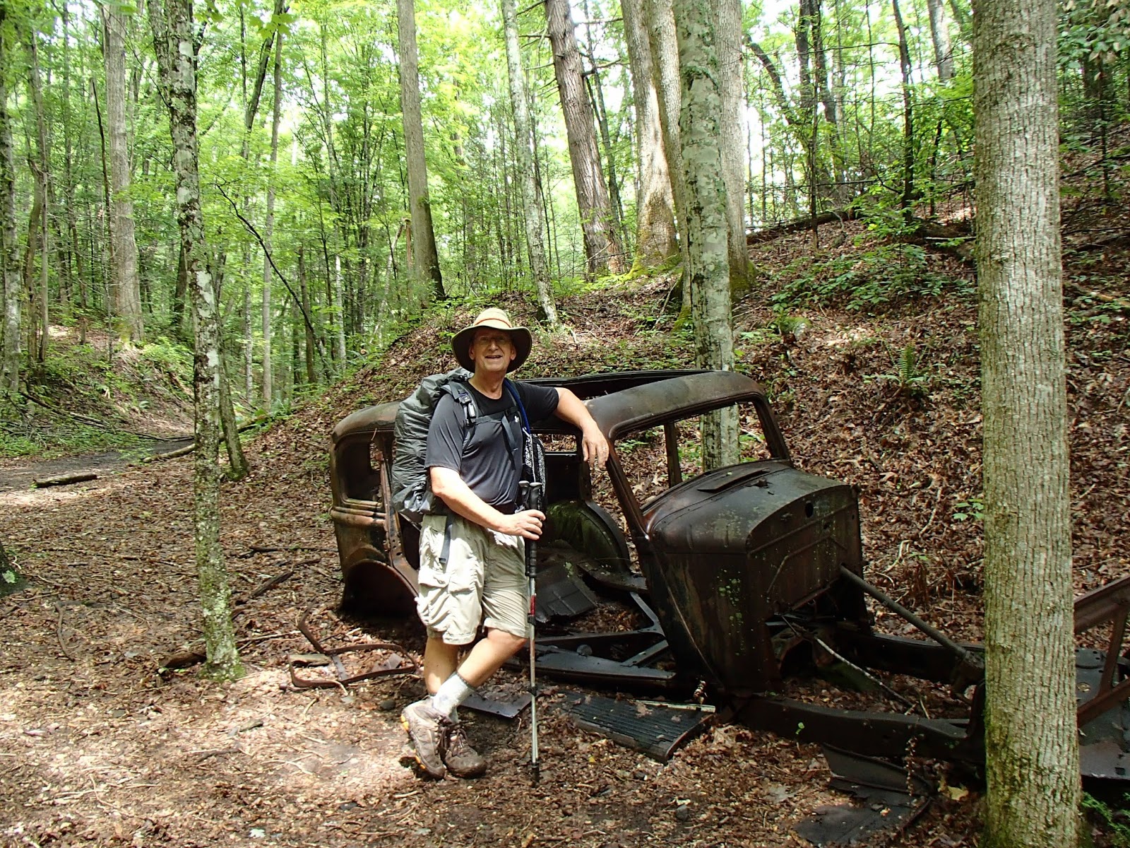
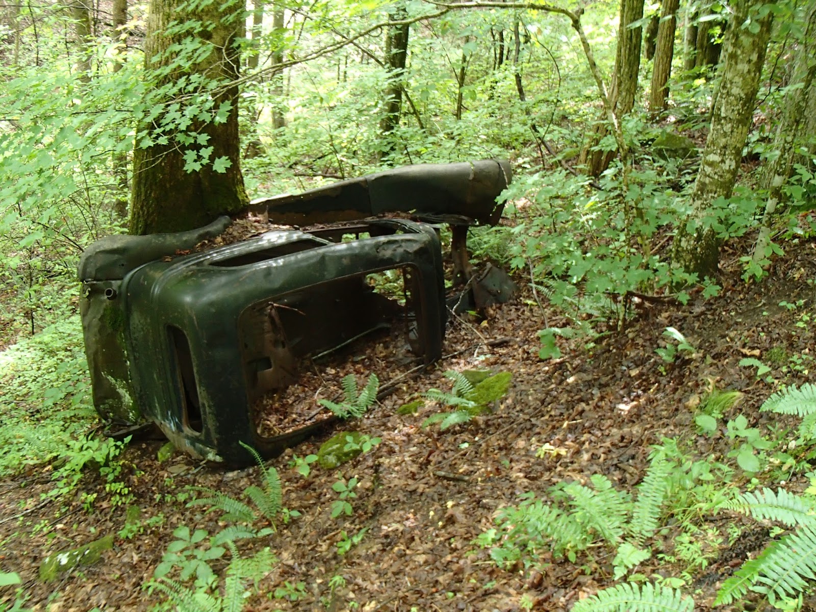
trail map and my record of hikes in the Smokies over the years with the Carolina Mountain Club, I discovered I had barely made a dent in the 800 miles, but I had a start.  In May, I hiked to Ramsey Cascades with the Friends of the Smokies (FOTS).
Ramsey Cascades - May 2014

It is an in-and-out hike of 8 miles, so I logged 4 miles for the trail.  There are many trails like this, so an in-and-out hike means you hike twice the miles you get credit for on there map.  It is estimated that most hikers cover many extra miles logging the over 800 actual trail miles.  Some trails are only accessible by hiking in on another trail; one that you may find yourself hiking multiple times to get to a more remote trail junction.

While hiking with the FOTS, I learned of a group of hikers who hike trails in the park on a regular basis.  The Margaret Stevenson Wednesday Hikers schedule one or more hikes each week.  My first hike with them was on June 4 and it was a serious hike that covered part or all of four trails for a total of over 18 miles.  It was a key swap hike, meaning my car was driven by someone else to where I would end the hike and I drove someone else's car to where I began the hike.  We would hike in opposite directions and swap car keys somewhere on the trail.

Start
 We began on the Lead Cove Trail to the Bote Mountain Trail (4.7 miles) to the AT at Spence Field.  A short distance to the Jenkins Ridge Trail for 8.9 miles to Hazel Creek and 4.5 miles to the North Shore of Lake Fontana.  While we were having lunch on Jenkins Ridge, we met the other group of hikers and completed the key swap.
Bote Mountain Trail Junction

 The Hazel Creek trail ended at Lake Fontana where we were picked up by a boat to shuttle us across the lake to Fontana Village Marina.  A boat ride was a nice way to end a long hike, and sure enough, my car was in the marina parking lot.  The logistics for the key swap were all worked out ahead of time by the hike leaders.


Since driving to the Smokies for day hikes takes time, my friend Rich and I camped three days at Cades Cove and hiked trails in the area.  Wednesday afternoon we hiked Rich Mountain Loop-Indian Grave-Crooked Arm trails (9miles); Thursday we hiked 13 miles on Abrams Falls Trail, part of Hannah Mountain Trail, and part of Rabbit Creek Trail.  On Friday we hiked to Gregory Bald on the Gregory Ridge Trail; another in-and-out hike. As the trailhead sign shows it is 5.5 miles to Gregory Bald, but we had to hike back - 11 miles hiked for 5.5 trail miles on the map.  The bald has a plethora of flame azaleas that were in bloom in mid-June.

A week later I was back with the Wednesday hikers for Hemphill Bald-Caldwell Fork-Rough Fork covering 13 miles.  One of the hikers in the group was finishing his map - meaning that hike completed his challenge of hiking all the trails in the park.  Also, two hikers finished their second map - meaning they have hiked all the trails of the Smokies TWICE!  We celebrated with refreshments at the cars.

The next hike was in the Deep Creek area near Bryson City.  We hiked part of the Noland Divide Trail, the Pole Road Creek Trail, and part of the Deep Creek Trail covering a little over 17 miles on those trails.

Two more days of hiking with the Friends of the Smokies in July added a few more miles of trails, including Metcalf Bottoms and the Little Brier Gap Trail on the first day, and Laurel Falls and Cove Mountain Trails on the second day.  The FOTS organized this event with an overnight stay at the Buckhorn Inn in Pittman Center, TN - not far from Gatlinburg.  Janice and I recommend the inn; there are rooms and cottages, and the dinner and breakfast were delicious.

So that covers most of the hikes over the past several weeks.  I hiked over 80 miles of new trail miles, and I can report I have 181miles so far.  I will try to blog individual hikes and not cover as much ground as I did in this report.