
We took a break from the MST 130 Challenge yesterday to hike the Black Mountain Crest trail, which as the name implies, follows the crest of the Black Mountains for 12 miles from Bolen's Creek to Mt.Mitchell. One of the hikers in our group of four needed 3 peaks in the Blacks to complete the South Beyond 6,000 (SB6K) challenge. This Carolina Mountain Club challenge involves summiting 40 peaks over 6,000 feet in elevation in Western NC and, in the Smokies, in Tennessee. 12 of these peaks lie in the Black Mountain, from Celo Knob in the north to Blackstock Knob in the south.
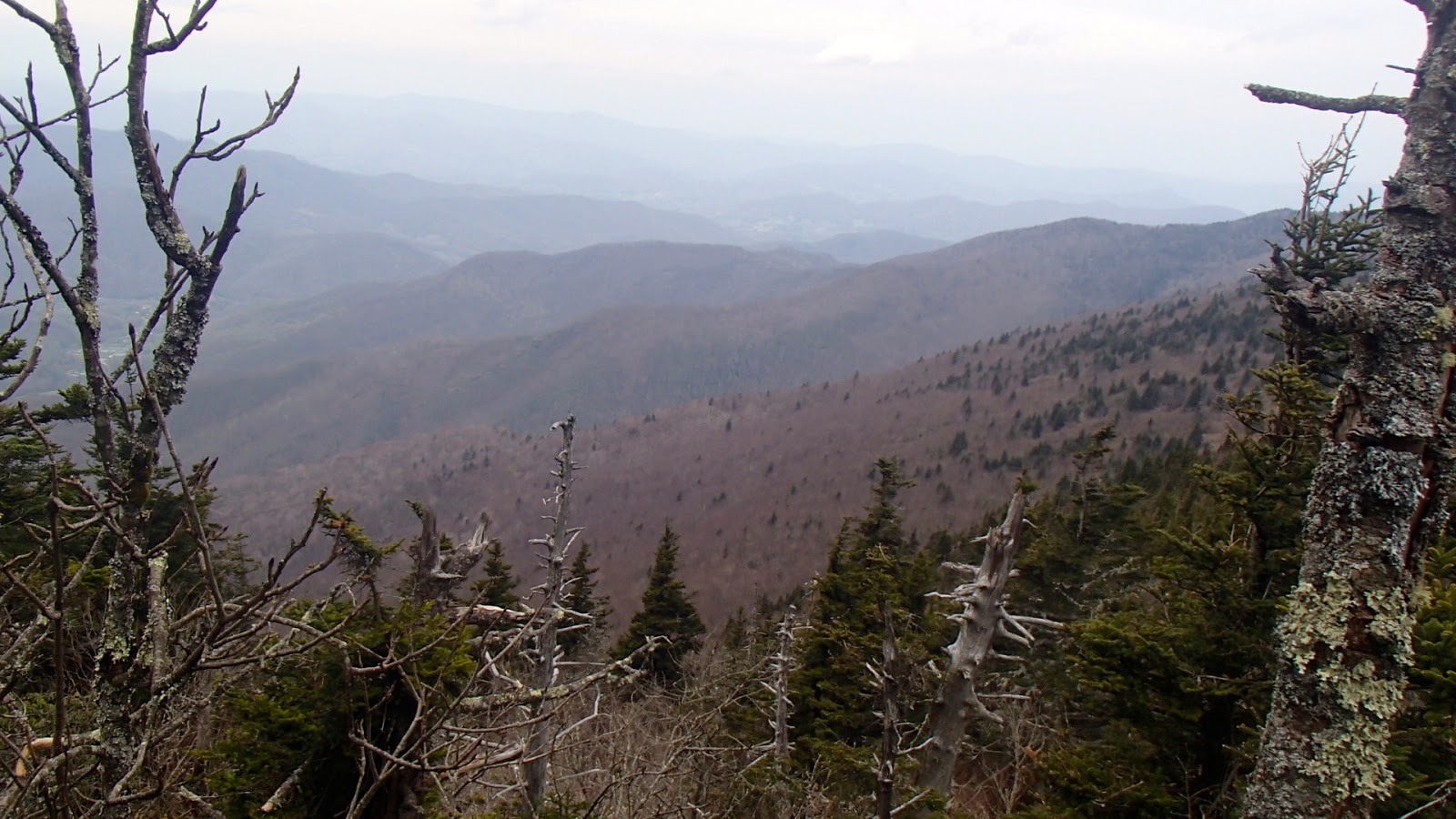
We began hiking a little after 8:00 am off Bolen's Creek Road. The trail ascends 3,000 feet in about 4 miles, so our day started with a sustained climb. It is evident when you reach the crest of the Blacks, because you can see virtually all the peaks you will be crossing as you hike south toward Mt. Mitchell. The picture above shows the view looking south. All the peaks shown are over 6.000 feet.
Gibbs Mountain was the first of the three peaks needed to complete the SB6K challenge, and it requires an off-trail bushwhack. We took off through the briars and trees, working our way up the short distance to the summit. Several rocks are at the top, and the high point did not provide much of a view. We worked our way back down and hiked south toward lunch and the next peak, Winter Star Mountain.
The trail up WInter Star is a series of steep climbs often very rocky. In some places you wonder where the trail went, then you realize that it is up and over the rocks ahead of you. Look for the trail in this picture. It is directly in front at the center of the picture.

The main features of the Black Mountain Crest trail are lots of ascending and descending, lots of rocks, and lots of roots. There is about the same amount of climbing along the crest as there was on the initial 3,000 foot climb at the beginning of the hike. At the end of the hike we had a total ascent of over 5,700 feet. The trail also provides expansive views east of the crest toward the South Toe River valley, and west of the crest toward the North Toe River valley. Some areas we open and there were many interesting rocks. Due to the extreme winters there are lots of blow downs, although the trail was mostly clear of them. Environmental conditions and insects have harmed the older trees, as seen by the ghostly skeletons still standing.


The weather was sunny to cloudy during most of the day. The temperature at 6.000 feet was comfortable, but we know the forecast was for rain later in the day. As we approached Big Tom and Mt. Craig over the last 2 miles of the hike the wind and rain started. Donning rain gear we continued on. Everything was socked in by clouds, so we lost any views we enjoyed earlier in the day.
After 8 hours of a steep and hard 12 miles we reached the car at the Mt. Mitchell parking lot. All in all a good day on the Crest.
A few more pictures from the hike.
 |
| View to the east |
 |
| Fern rock garden |
 |
| Looking southeast |
New blog. Congratulations, Steve. I will certainly follow it.
ReplyDeleteMaybe we should accumulate all the blogs written by CMC members.
I'm at hikertohiker.com